How NASA is Clearing the Skies for Emergency Drones: Q&A on Airspace Prioritization
As drone technology rapidly evolves, our skies are becoming as congested as our streets—especially with commercial delivery drones. But what happens when a police or rescue drone needs to race through that crowded airspace? NASA is stepping up with innovative solutions to ensure first responders get the same priority in the air that fire trucks and ambulances get on the ground. This Q&A explores a recent groundbreaking flight exercise in North Texas and the technology that could make emergency drone operations safe, fast, and seamless.
1. Why is NASA researching drone airspace prioritization for first responders?
Just as drivers pull over for emergency vehicles on the road, drones must yield to first responder drones in the sky. With the expected surge in commercial drone flights for deliveries and other tasks, NASA recognizes that public safety drones—used by police, fire, and rescue services—cannot afford delays. Their missions often involve life-or-death situations, such as searching for missing persons, monitoring fires, or pursuing suspects. Without a clear system to prioritize them, these drones could get stuck behind slower commercial traffic, wasting precious time. NASA is developing air traffic management tools that give public safety operators real-time priority access, ensuring they can navigate crowded skies quickly and safely. The goal is to create a scalable, responsible framework that balances the needs of all drone operators while keeping safety paramount.
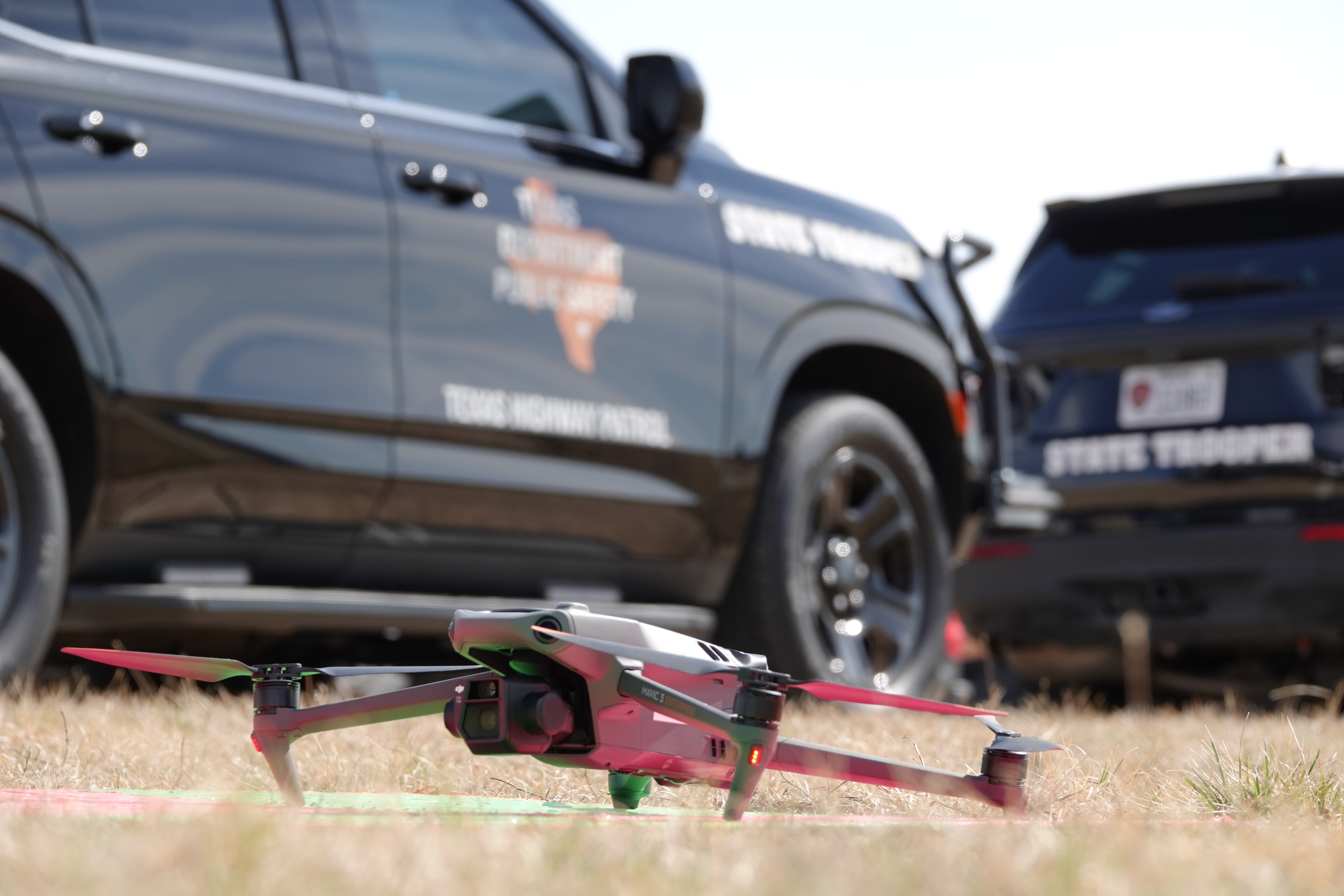
2. What happened during the North Texas flight exercise?
On February 18, NASA Ames Research Center, Texas public safety agencies, industry partners, and the Federal Aviation Administration came together in North Texas for a live flight test. The region is an FAA-designated area where commercial drone deliveries already fly daily. During the exercise, first responder drones—simulating police, fire, and rescue missions—were launched into the same airspace as commercial drones. Using NASA’s airspace prioritization tools, the system automatically directed commercial drones to move aside when an emergency drone approached. Additionally, when multiple public safety organizations responded to simulated emergencies, they communicated among themselves to decide which drone should get the highest priority. The successful test demonstrated that real-time prioritization is feasible and can keep the skies safe for everyone.
3. How do emergency drone missions differ from commercial drone flights?
Emergency drone missions are inherently unpredictable. Unlike commercial delivery drones that follow predetermined routes from warehouse to customer, first responder drones often need to change direction instantly. For example, during a search-and-rescue operation, a drone might zigzag across a forest; during a pursuit, it may suddenly accelerate or turn to follow a fleeing vehicle. As noted in the North Texas exercise, one test involved a drone tracking an SUV driving erratically to simulate a high-speed chase. This unpredictability poses a challenge for air traffic systems designed for steady, predictable flight paths. NASA’s research focuses on building tools that can handle these volatile maneuvers while still allowing commercial drones to operate efficiently nearby. The key is to prioritize safety without grounding all other traffic.
4. How does the prioritization system work in practice?
The system works like an intelligent air traffic controller for drones. When a first responder drone launches, it sends a signal to a central traffic management platform that declares its priority status. Other drones in the vicinity receive an instruction to adjust their paths—slowing down, hovering, or rerouting—to clear a corridor for the emergency vehicle. This happens in real time, often within seconds. If multiple public safety agencies are involved, they can coordinate through the platform to decide which mission takes precedence. According to NASA research lead Abhay Borade, the system is designed to prioritize the safety of flight operations while balancing efficient use of the airspace for all operators. The result is a dynamic, responsive network that ensures emergency drones never face gridlock.

5. What role did the simulated vehicle chase play in the testing?
During the Texas exercise, researchers wanted to understand how unpredictable movements—like a drone following a fleeing suspect—affect nearby commercial drone activity. They had a drone track an SUV driven erratically, mimicking a law enforcement pursuit. This provided crucial data on how the prioritization tools handle sudden changes in speed, direction, and altitude. The results showed that NASA’s system could still manage the airspace safely: commercial drones were rerouted quickly, and the emergency drone completed its mission without interference. This test was especially important because it validated that the technology works under realistic, high-stress conditions. By studying such scenarios, NASA is building a solid foundation for future drone traffic management that can adapt to the unpredictable nature of public safety operations.
6. What are the next steps for integrating first responder drones into crowded skies?
With the success of the North Texas exercise, NASA plans to refine its prioritization tools and expand testing to more complex environments. Future steps include working with the FAA to develop regulations that allow emergency drones to receive priority in non-test areas. Researchers also aim to incorporate artificial intelligence to predict potential conflicts before they happen. Additionally, they will explore how these systems can scale across large metropolitan areas where thousands of drones might operate simultaneously. The ultimate goal is to create a national airspace framework where public safety drones can fly seamlessly alongside commercial drones, just as emergency vehicles navigate our roads. As NASA’s Shivanjli emphasized, collaboration with industry and federal partners is key to building a safe, responsible, and scalable future for drone operations.
7. Who are the key partners in this NASA project?
This project is a collaborative effort involving multiple stakeholders. NASA’s Ames Research Center leads the research, bringing expertise in air traffic management. Critical partners include local and state public safety organizations in Texas, such as police and fire departments, who provide real-world operational knowledge. The Federal Aviation Administration (FAA) is also closely involved, ensuring that any new technology aligns with national aviation regulations. Industry partners—companies that manufacture drones or provide commercial delivery services—contribute by allowing their drones to participate in tests and by sharing data on flight patterns. This public-private partnership ensures that the prioritization system meets the needs of all users. As noted in the original article, the North Texas region itself is an FAA-designated testbed for daily commercial drone operations, making it an ideal location for this cutting-edge research.
Related Articles
- Star Wars Day: Lego Unveils Ultimate Collector Series N-1 Starfighter, Free Darksaber Model with Pre-Order
- 7 Surprising Ways Your Sense of Self Location Shapes Your Life
- 10 Key Insights into Sakana AI's KAME: Redefining Real-Time Conversational AI
- 10 Lessons from Storytelling That Transform User Research
- VS Code Python Environments Overhaul: Startup Speed and Reliability Take Center Stage in April Update
- Decoding Lightning: A How-To Guide on the Latest Understanding
- The Atacama Incident: A Step-by-Step Guide to Dislodging a Stuck Rock Sample on Mars
- The Hidden Cost of a 'Bug-Free' Team: What AI Efficiency Takes Away