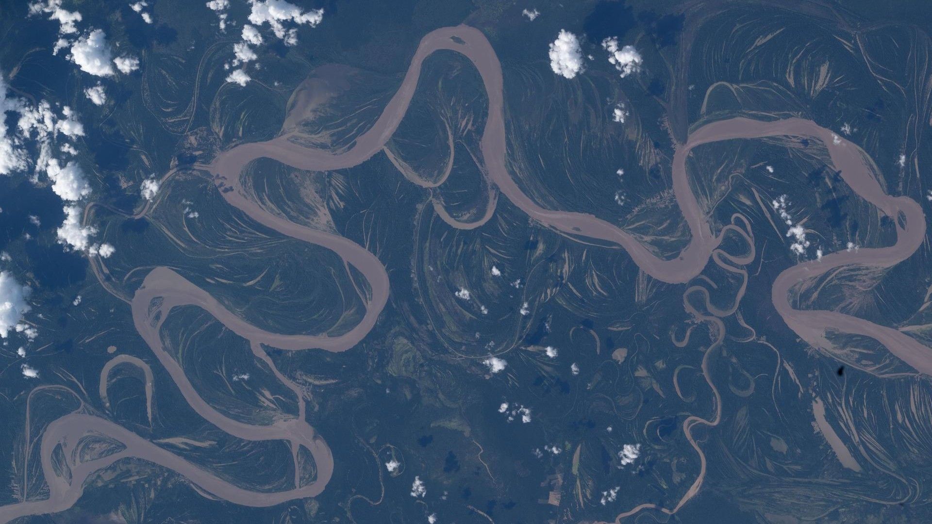
NASA Astronaut Captures Winding Amazon River from Space – New Concerns Raised Over Deforestation
April 30, 2026 – A striking new image from the International Space Station (ISS) reveals the Ucayali River snaking through the Amazon rainforest, providing scientists with fresh evidence of how deforestation is altering the region's hydrology. The photograph, taken by NASA astronaut Jessica Meir, shows the river's dramatic meanders cutting through dense green canopy, a visual testament to both natural power and human pressure.
Key Highlights
- Photographed by: NASA astronaut Jessica Meir from the ISS
- Location: Ucayali River, a major tributary of the Amazon in Peru
- Significance: Illustrates river morphology and deforestation impact
- Context: Part of ongoing Earth observation for climate monitoring
Expert Reactions
“This image is a stark reminder of how dynamic our planet is, and how quickly human activity can change its face,” said Dr. Elena Torres, a hydrologist at the University of São Paulo. “The Ucayali is a living laboratory for studying river migration and the effects of forest loss.”

Meir herself described the view as “breathtaking and sobering” in a post on social media. “From 400 kilometers up, you see the rivers as arteries of life, but also the scars of clearing,” she wrote.
Background
The Ucayali River, originating in the Peruvian Andes, is a primary source of the Amazon River. Its sinuous course is constantly shifting due to erosion and sediment deposition, a natural process that supports diverse ecosystems.
However, rapid deforestation in the region – driven by agriculture, logging, and mining – has accelerated bank erosion and sediment loads. Scientists have warned that these changes threaten water quality and biodiversity.
The ISS has been a crucial platform for Earth observation for decades. Astronauts routinely photograph landscapes to supplement satellite data, providing high-resolution, near-real-time views of environmental change.
What This Means
This image underscores the importance of continuous space‑based monitoring. As deforestation alters river behavior, understanding these shifts becomes critical for managing water resources and predicting floods.
“We can no longer separate river dynamics from land‑use decisions,” added Dr. Torres. “Images like this help us communicate urgency to policymakers.”
The Ucayali's meanders also serve as a proxy for broader climate impacts. If deforestation continues, the river's ability to regulate local rainfall and carbon storage could be severely compromised.
Urgent Call for Action
Environmental groups are using the photograph to renew appeals for stricter protections. The Amazon basin loses an area of forest equivalent to three football fields every minute.
“This isn’t just a pretty picture – it’s a warning,” said Marcos Rios of Rainforest Alliance. “We need to act now to preserve the lungs of our planet.”
For more on Amazon conservation, see our background on river systems.
Related Articles
- Empowering AI Agents with Secure Desktop Access: A Step-by-Step Guide to Amazon WorkSpaces for AI Workflows
- Preserving the Human Glue: A Guide to Balancing AI Efficiency with Team Connection
- Mastering the Python Environments Extension in VS Code: A Comprehensive Guide
- How Freezing and Thawing May Have Jumpstarted Life on Early Earth
- The Complete Skywatcher's Guide to the Strawberry Moon of June 2026
- Dinosaurs Were Social, Sophisticated Creatures, New Findings Show
- Fructose's Hidden Impact: How This Common Sweetener May Be Disrupting Your Metabolism
- How to Track App Download Trends and Respond to Slowdowns